Belhaven Bay, Dunbar
26th November
 *** Results***
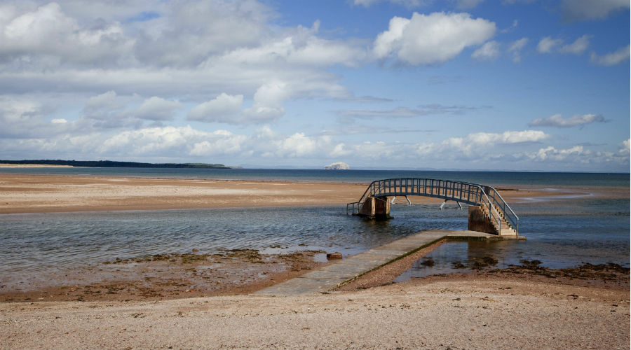
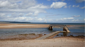
Report: Over 80 entries on a chilly winter afternoon was a gratifying turnout. And a high proportion of those entries were current ELO members – plus a few past and hopefully some future members appearing too. Each course was won by an ELO member with Angus Wright being the fastest on both Yellow and Orange. Runners on Green enjoyed the novelty of an outing onto Spike Island with technical navigational detail in the dunes – and no-one got stranded by the tide at ‘the bridge to nowhere’. There was the added bonus of seeing a distinctive white egret feeding in the Biel just below the bridge unconcerned by our coloured lycra flashing (?) past. PY
Advance info:
The next ELO event will be at West Barns near Dunbar on Saturday 26th November. The planner is Trina Rogerson and there will be the usual range of courses for a local event. The shorter courses stay within the shore area and adjacent caravan park but the Green course includes some technical legs across the estuary on Spike Island and therefore is subject to the tide and has specific Start / Finish times …
- White / Yellow / Orange – Starts from 13:30 until 14:30 – courses close at 15:15
- Green – Starts from 14:15 until 14:45 – course closes at 16:00.
Final Details
Location
Nearest town: Dunbar
Grid Ref: NT663786
Postcode: EH42 1NU
Course Information
- White ( very easy) 1.5 km – 1:2500 map
- Yellow (easy) 1.7 km – 1:2500 map
- Orange (moderate) 2.8 km – 1:3000 map
- Green (hard) 5.4 km – – 1:7500 map
very little climb on any course.
Entry Charges
- Seniors (born 1995 or earlier)
British Orienteering members – £3
Non-members – £5 - Juniors (born 1996 or later)
British Orienteering members – £1.50
Non-members – £2.50 - Groups (Adults + children)
Each additional adult in a group: add £1 - Each additional junior in a group: add 50p
Planner: Trina Rogerson
Privacy: when entering our events your name may appear in the results section of this website or in newspaper reports.