Binning Wood

Binning Wood Map
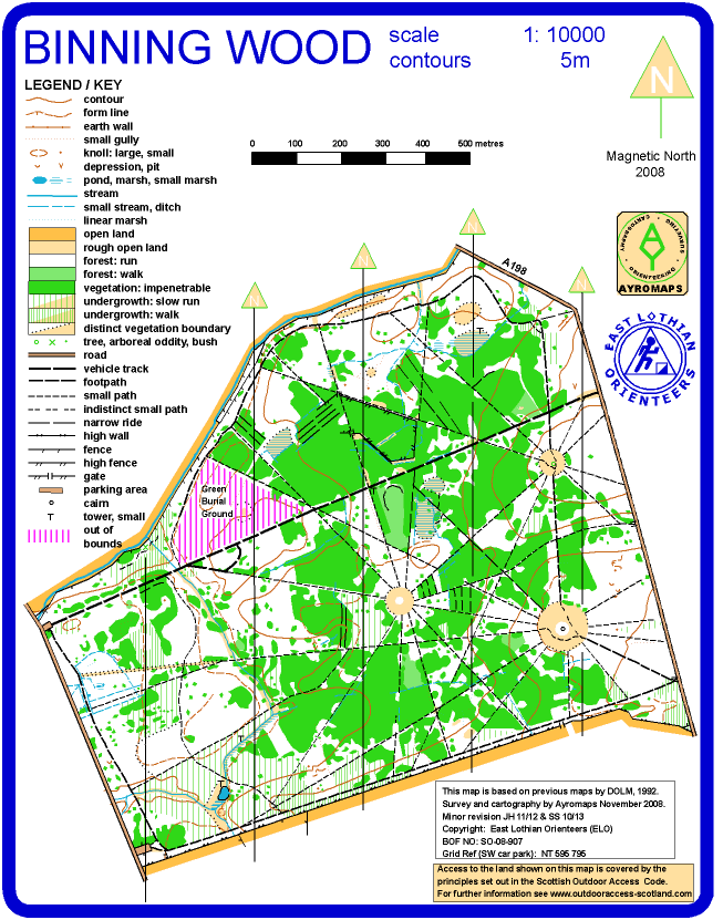
Binning Wood Map
Location: East Linton
Grid Reference: NT595795
Scale: 1:10000
Size: A4-
Last revision: 10/2013
A historic wood whose complex system of rides and clearings was originally set out in the early 18th century. Work is going on to clear some of the rhododendron which will improved the runability.
The oob area in the north of the map is a green burial site.
note that parking is either in the SW, NW or SE corners of the wood. Check the details for any specific event
Note that the production of orienteering maps takes many hours of professional or volunteer’s work and that permission to use areas for an event should not be taken for granted. Please contact the club to purchase copies of the map and to discuss possible use.